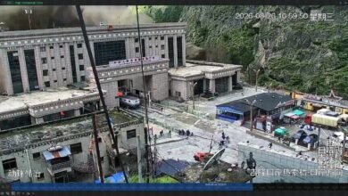
Nepal-Tibet Floods Latest: Rescue Expands as Toll Rises and Thousands Remain Missing

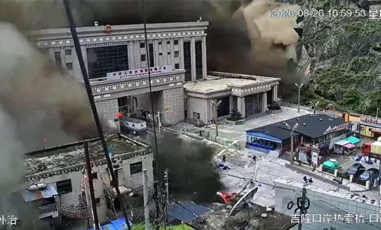
Rescue and recovery teams expanded their search across the Nepal-Tibet border region on Saturday as the scale of the August 26 flash-flood disaster continued to grow.
Figures compiled by authorities and international agencies by the morning of August 29 indicated at least 579 deaths in Nepal and seven in Tibet. Nearly 2,500 people were still listed as missing across the two jurisdictions. Both totals remain provisional: damaged communications, duplicate missing-person reports and the difficulty of reaching isolated settlements can cause substantial revisions.
Search continues across damaged river corridors
More than 13,000 members of the army, police and other security services have been mobilised. Teams are working through deep mud, unstable debris and broken transport links in and around Rasuwa, Nuwakot and the Gyirong border zone. Helicopters, drones, boats and earth-moving equipment are being used where weather and terrain permit.
Road and bridge losses have made access especially difficult. Early assessments identified more than 35 damaged or destroyed bridges and about 40 kilometres of affected roads. Border facilities, homes, vehicles and sections of hydropower infrastructure were swept away or buried.
Foreign nationals and pilgrimage groups are among those still unaccounted for. Around 320 Indian citizens were reported missing in the wider disaster area, while other governments were tracing their own nationals. These lists can include travellers who have reached safety but have not yet restored contact.
Humanitarian needs are rising
Relief agencies estimate that more than 93,000 people have been caught up in the emergency and need some form of assistance. About 17,000 children require urgent support. Immediate priorities include safe water, food, temporary shelter, medical care, sanitation and restoring contact between separated families.
Floodwater and mud can contaminate local water systems even after river levels fall. Communities returning to damaged areas also face unstable slopes, exposed electrical equipment and structures weakened by impact or erosion.
What preliminary evidence says about the cause
Satellite imagery and seismic analysis point to a huge collapse involving bedrock, glacier ice and snow near the border. The mass fell more than a kilometre, entered a river valley and generated a fast-moving mixture of water, rock, ice and sediment. A seismic signal initially described as a magnitude 5.2 earthquake was later identified as the collapse and debris flow itself.
Hydrological observations showed how exceptional the surge was: the Trishuli River rose by as much as nine metres in roughly half an hour at one stage. That speed left communities with very little time to react.
Why the danger has not completely passed
The original collapse changed the shape of channels and left large volumes of unstable material upstream. A separate barrier lake subsequently formed and began releasing water, prompting a second warning and a temporary pause in parts of the rescue operation.
People in affected valleys should continue following instructions from Nepal Police, the Flood Forecasting Division and local administrations. Riverbanks and debris fields are not safe viewing locations. A falling water level at one monitoring point does not guarantee that an upstream blockage, landslide or sudden release cannot produce another local surge.
Update timestamp: 29 August 2026, 10:30 a.m. IST. Casualty and missing-person figures are expected to change as official lists are reconciled.