NASA and IBM Release Open-Source AI Model to Map the Moon

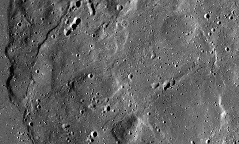
NASA and IBM have released an open-source artificial-intelligence model designed to help researchers interpret the Moon’s complex surface. The Lunar Foundation Model is trained on roughly two million image tiles drawn mainly from NASA’s Lunar Reconnaissance Orbiter and complemented by other mission data.
Its purpose is not to replace planetary scientists. Rather, it is intended to give researchers a reusable starting point for tasks that otherwise require time-consuming manual review or a new model trained from scratch.
What the model is meant to do
NASA says the model can support mapping of craters, volcanic features and areas that may contain water ice near the lunar poles. Those are scientifically valuable targets: crater records help reconstruct the Moon’s history, while polar ice is relevant to future exploration and to understanding how volatile materials move through the solar system.
A foundation model learns broad patterns from large datasets, then can be adapted for narrower tasks. In planetary science, that can make it easier for teams with limited computing resources to test questions across very large image archives.
Open source does not remove the need for scrutiny
Making the model and supporting work available publicly can broaden participation, but scientific use still depends on validation. Image classification systems can inherit biases from training data, perform differently in unusual terrain and produce confident-looking errors. Researchers must compare outputs with observations, geology and independent measurements.
That is especially important for claims involving possible ice deposits. A model may help prioritise places to investigate, but it cannot by itself prove what material lies beneath a surface feature.
Why it matters for exploration
The release arrives as lunar science and exploration attract renewed attention from governments and commercial missions. Better tools for analysing existing data can help mission planners identify high-value terrain and help researchers extract more knowledge from instruments already in orbit.