What May Have Triggered Nepal’s Flood — and Why Scientists Warn of Another Surge

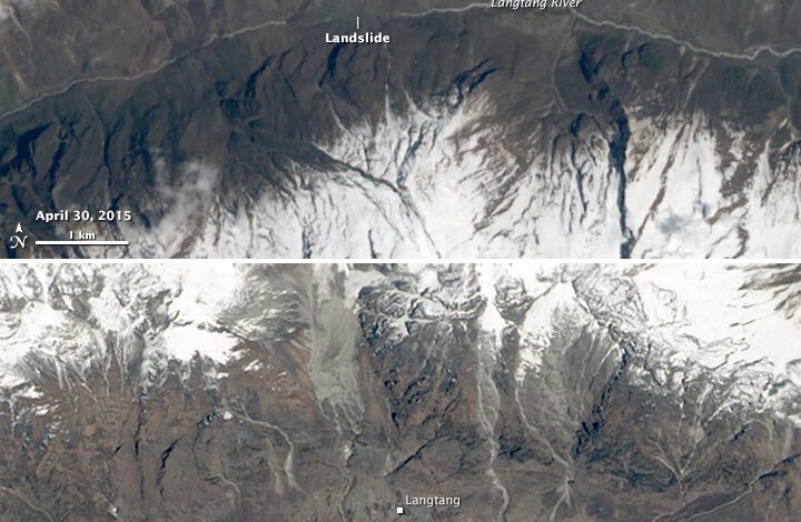
The violent surge that swept through Nepal’s Rasuwa district was extraordinary in both speed and sediment load, but scientists have not yet completed the evidence needed to declare a single cause. The leading preliminary explanation is an ice-rock avalanche high in the Lhende Khola catchment that displaced or released a huge volume of water, sediment and boulders into the Bhote Koshi and Trishuli systems.
The International Centre for Integrated Mountain Development said partner institutions in Nepal and China were investigating that possibility. Its early analysis measured how exceptional the flood wave was: the river at Galchhi rose by as much as nine metres in about 30 minutes, while the level at Malekhu rose by roughly seven metres in the same period.
A seismic signal was not necessarily an earthquake
An early automated alert described a magnitude 4.4 earthquake north of Kathmandu. The United States Geological Survey later revised its interpretation of the recorded signal to a magnitude 5.2 glacial-collapse event. Large avalanches and landslides can generate ground vibrations that seismic networks initially classify as earthquakes before analysts compare waveforms and satellite observations.
That revision is important, but it does not by itself provide a complete reconstruction. Investigators still need to establish the starting point, the volume of ice and rock involved, whether a temporary lake or river blockage formed, and how the moving mass transformed into a destructive debris-rich flood.
Why a second flood remains possible
Preliminary observations indicated that an upstream obstruction had not fully cleared. A natural dam made of ice, rock or landslide debris can store water behind it. If it erodes gradually, the river may remain elevated for hours or days; if it fails suddenly, another flood wave can travel downstream even without heavy local rain.
This is why evacuation warnings extend beyond visibly damaged villages. People should follow official instructions, avoid returning to unstable banks and not assume that falling water at one monitoring point means the entire river system is safe. Several monitoring stations were damaged, leaving gaps precisely when continuous data is most valuable.
Climate risk and scientific caution
The Hindu Kush Himalaya is warming rapidly, and retreating glaciers, thawing slopes and changing snow and rainfall patterns can increase several kinds of mountain hazard. The Lhende system also experienced a destructive glacial-lake flood last year, underscoring that the corridor faces repeated risk rather than an isolated engineering problem.
However, broad regional change is not the same as proof that climate change caused this particular event. Event attribution requires data, modelling and comparison with a climate that has not experienced human-driven warming. ICIMOD cautioned that it was too early to make that attribution for the August 26 disaster.
What should be investigated next
A credible inquiry will combine high-resolution satellite images, seismic records, river gauges, field mapping and witness timelines from both sides of the Nepal-China border. It should also examine how quickly warnings moved between agencies and whether communities downstream received usable instructions before the surge arrived.
Longer-term protection will require more than rebuilding the same roads and bridges. Redundant sensors, satellite-based detection, cross-border data sharing, evacuation maps and infrastructure designed for debris-heavy flows can reduce future losses. The immediate scientific message is restrained but urgent: the suspected mechanism is plausible, the exact trigger is not yet settled, and the possibility of another release must be treated seriously.