
Cyclone Akvan Tracks Toward Andhra Pradesh: Latest Forecast and Risks

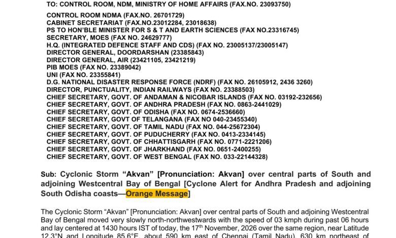
Cyclonic Storm Akvan was almost stationary over the Bay of Bengal late on November 17, but India’s weather agency warned that the pause should not be confused with weakening. The system was forecast to strengthen as it moved toward the Andhra Pradesh and Yanam coast, bringing a risk of destructive wind, very heavy rain, rough seas and coastal flooding around the expected November 20 landfall.
At 5:30 p.m. IST on November 17, the India Meteorological Department placed Akvan near 12.3 degrees north and 85.6 degrees east—about 590 kilometres east of Chennai, 650 kilometres southeast of Machilipatnam, 650 kilometres south-southeast of Visakhapatnam and 780 kilometres south of Gopalpur. Forecast positions change as new satellite and ocean observations arrive, so residents should use the latest IMD bulletin rather than treat these distances as a permanent track.
What the forecast says
IMD expected the cyclone to move slowly north-northwest and become a severe cyclonic storm on November 18, then strengthen further into a very severe cyclonic storm around November 19. The forecast track brought it toward the Andhra Pradesh–Yanam coast between Nellore and Visakhapatnam, with earlier bulletins narrowing the likely crossing zone and timing around November 20.
A cyclone’s centre is not its entire hazard area. Rainbands, squalls and high waves can extend hundreds of kilometres from the eye. A forecast cone shows where the centre may travel; it does not mean places outside the cone are safe. Changes in speed can also alter whether the worst rain coincides with high tide.
Why slow movement can increase the rain threat
A slowly moving storm can draw moisture over the same districts for longer. Even before landfall, outer bands may saturate soil and fill drainage systems. Urban flooding, river rise and landslides can therefore become serious while the cyclone is still offshore.
Coastal Andhra Pradesh has densely populated cities, fishing communities, ports, farms and aquaculture operations. Strong wind can damage weak structures and power lines, while salt water can affect fields and drinking-water sources. Farther inland, the principal hazard may be rain rather than wind.
Ports and fishers face earlier deadlines
IMD’s coastal bulletin instructed ports in Odisha to keep distant warning signal number two hoisted as conditions worsened. Sea conditions were expected to become rough, and official advice had already urged fishers to return to shore. Waiting until landfall is unsafe because small boats need time to reach harbour and ports may restrict movements as waves rise.
Commercial shipping and offshore operations should use marine bulletins that cover wind, wave height and restricted areas. Travellers should check airlines and rail operators directly. A forecast of landfall near one section of coast can still cause cancellations elsewhere as equipment and crews are moved.
What “very severe” means—and does not mean
IMD classifies North Indian Ocean cyclones by maximum sustained wind. A very severe cyclonic storm is a high category with the potential for major damage. It is not a prediction that every location in the warning area will experience the same wind speed. Terrain, distance from the track, building quality and local gusts change the impact.
Likewise, a forecast category is not a final measurement. Storms can intensify faster or slower than expected. Coastal residents should base decisions on evacuation orders and district instructions, not on whether a social-media account says Akvan has crossed a particular threshold.
Practical preparation
Families in warned areas should charge phones and power banks, store safe drinking water, secure loose outdoor objects and keep medicines and identification in a waterproof bag. Anyone in a low-lying coastal or river area should know the nearest official shelter and route. Livestock and pets require plans before transport becomes difficult.
During intense wind, stay away from windows and do not shelter under trees or weak roofs. Floodwater can hide open drains, electrical hazards and fast currents; walking or driving through it is dangerous. Generator exhaust must remain outdoors because carbon monoxide can accumulate without smell.
Beware recycled cyclone images
Images of earlier Bay of Bengal storms often reappear during a new warning. A dramatic satellite picture or flooded street is not evidence of Akvan unless its source, date and location are verified. Forecast maps can also become obsolete within six hours. This article’s featured image is an official IMD forecast-track product from November 17; the latest live bulletin should take priority.
The correct response to uncertainty is preparation, not panic. Akvan’s slow movement left time for authorities and households to act, but it also increased the chance that conditions would change before landfall. The most useful information will come from IMD, state disaster agencies, district administrations and local emergency services as the storm approaches.
Sources
- IMD National Bulletin No. 16, November 17, 2026
- IMD coastal weather bulletin
- IMD Akvan bulletin archive and latest updates